Saturday, October 16, 2021

PCT Statistics

Today marks one month since I reached Canada on the PCT. In that month, I've been able to do some traveling and decompress a little bit. I've also been able to reflect some on my hike and I've compiled some of my statistics which can be seen here.

I completed the trail (including the 30 miles back to Hart's Pass) in 143 days, averaging 17.6 miles per day - 19.7 miles per day if you don't count zero days. I took 15 zeros and 18 nearos (days where I walked less than 10 miles). 21 of my days were marathon days where I walked at least 26.2 miles.

The PCT is just over 2,650 miles long, but as a result of three fire closures from last year and one active fire that I had to skip around, I ended up hiking just under 2,500 miles of the actual trail. The "total miles walked" includes camps that were slightly off trail, resupplies that we had to hike a ways to, and side trails like Mt. Whitney, but not any walking around towns (which I did a LOT of but have no way to measure).

Near the end of the hike, Frank and I had a 7-day period where we hiked 185 miles of trail which means that we averaged 26.4 miles per day during that span. No wonder we were tired...

Interestingly, I only spent one night camping alone (on day 14). I went into this hike expecting to camp alone a lot more often, but that didn't happen and I'm thankful that I got to camp with so many awesome people.

Coming out of Snoqualmie Pass, Frank and I climbed almost 8,000 feet in one day. That's 1.5 miles of vertical elevation that we climbed.

I ended up spending a little more than I had planned for this trip, but I'm ok with the amount I spent (it's more than the average hiker though). Towns are where all the money gets spent and I definitely noticed that my expenses decreased dramatically when Frank and I powered through Washington and barely made any town stops.

As for animals (not on this graphic), I saw 8 bears (including 3 cubs), 4 rattlesnakes, 1 moose, a handful of elk, and countless deer, marmots, pika, chipmunks, birds and squirrels.

Overall though, these statistics add up to one amazing life experience that I'm so thankful I got to have. Now it's on to the next one, whatever that may be!

Saturday, September 18, 2021

Day 143 - Friday, September 17

At Frank's friend Mary's house in Bellingham (Reached Hart's Pass and the end of the hike, southbound mile 30.6). Walked 26.9 miles today.

Last nights temperatures were comfortable and it didn't get chilly until near morning when the wind picked up. We got out of camp early this morning as the weather forecast is less than desirable.  There's an 80% chance of rain for most of today and it's going to be cold, so there could be snow mixed in at the higher elevations.

We set off and soon ran into Thin Mint who was heading down to the terminus.  She didn't stop to chat as she wanted to beat the bad weather (I don't blame her for that at all!).  We continued on the way we came yesterday.
About 8am it started to lightly sprinkle and it continued like that for a few hours.
We hiked without stopping much as it got cold quickly, especially with the wind.  We reached more sheltered areas and got a bit warmer as we climbed, passing Flavortown on her way to Canada.  We stopped at the campsite from the night before last and ate a tiny bit (but it was hard to with the cold).

With about 8 miles to go, we came across Frank's friend Mary hiking the other way.  She is picking us up from Hart's Pass today and wanted to do some hiking, but we didn't expect to see her so far in.  We continued on through much heavier rain, getting more and more soaked.

We ran into Magnet, Narrator, and Sunshine and said our congratulations and farewells.  Just after this, a hiker we've been leapfrogging the past week or so, Butt Tape, passed us.  When we mentioned that Mary was our ride, he asked if he could join.  We all agreed and he fell in line behind us.

The wind picked up, the temperature dropped, and the rain got worse as we continued toward the pass.  Finally, we reached the car at 4:42 pm, officially ending our hike.  Shivering, I went to the bathroom and changed into some clothes Mary had brought for us.  It was difficult to use my fingers, they were so cold.

We got in the car with the heat blasting and the temperature reading 37 degrees out.  No wonder we were cold.  Mary drive us down the pothole-filled and hairpin gravel road to Winthrop where we had dinner at a Mexican restaurant.

Mary drive us through the dark and the rain back to civilization.  We dropped Butt Tape off at his hotel and then got to Mary's house just before midnight.  Frank and I showered and went to bed, finally ending our long adventure but ready for another.

I don't really feel like this adventure is over yet though. I feel like we're just going into town for another stop, but this is the end of my PCT thru hike.

As for my next plans, tomorrow, Frank and I are going to her friend's wedding in Snoqualmie.  We rushed the last few weeks so that we could finish the trail before the wedding. That ended up being a good call as it's supposed to be snowy and rainy in northern Washington for the next three days. My mom and sister will be in Seattle next week, so I'll be touring and visiting with them before doing some more exploring on the west coast - not sure what, but I'm sure I'll find something to do before heading back east to Virginia. As for my career, I'm looking into the GIS field for my next venture (and plan on doing a GIS map of this hike in the meantime, so stay tuned for that).

As this trip ends, I want to thank everyone who supported me and followed along through this journey.  I did this walk and took the steps, but it could not have been done alone.  I had so much help and support along the way.  A huge thank you to my mom for coordinating my resupply boxes and keeping up with my 'normal' life while I was on the trail.  Thank you to my friends, family, former co-workers, and directors who followed and encouraged me, sent letters or emails, and sent resupply boxes or covered my resupply in town. Thank you to the trail angels who gave rides, meals, or helped me out along the way. Finally, a huge thank you to my friend and hiking partner for over 2100 miles, Frank.  She helped me through the rough days, up the big climbs, and through the pains of thru hiking.  My journey couldn't have been done without you.

Day 142 - Thursday, September 16

Tenting at the PCT and Pacific Northwest Trail junction (Finished the PCT at mile 2653.6; southbound mile 3.7). Walked 25.0 miles today.

Last night's low was supposed to be 28, but I'm certain it was colder than that. The condensation on the tent this morning was all frozen and it took us a long time to get up and get going. Frank finally left camp about 7:45 with me 15 minutes behind. I ran into Frank after a few minutes and she had come across Jedi. He had tagged the monument yesterday. We chatted briefly before heading up the trail. About 20 minutes later, we ran into AB. She had also reached the border the day before and after a quick chat, we were off again.

We had been seeing a bunch of thru hikers hiking south after completing their thru hikes and they all congratulated us on our hike and reaching the border.
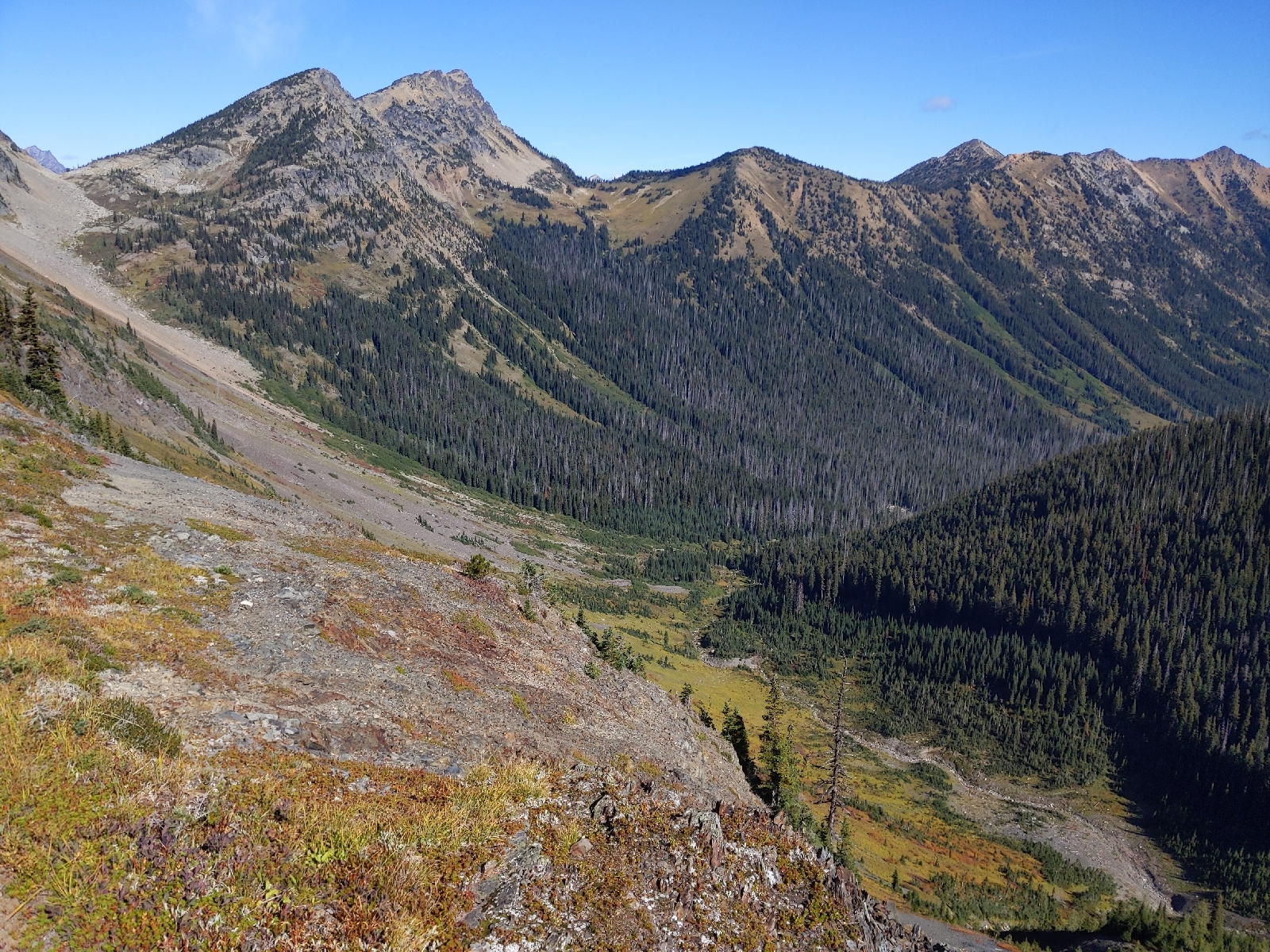
We had great views as we crossed Rock Pass and Woody Pass and hiked up to a viewpoint where we rested for a few minutes.
We then hiked above and then down past Hopkins Lake.
From here, it was all downhill the rest of the way. I spent the next 6 or so miles thinking about this hike and what I had accomplished. After what seemed no time at all, we hit a series of switchbacks, came around a corner, and there it was: the Northern Terminus of the PCT.
We had reached the Canadian border. The monument is in a 20-foot wide clear cut that signifies the border between the two countries. Frank and I tagged the monument, then took pictures, signed the log book, and admired the monument and what we had accomplished.  It feels like a lifetime since I left Mexico but it's only been 4.5 months of an incredible journey.
At this point, I should tell you that I've been lying about how much weight I've been carrying. You see, I have 23 grams of weight that's not included in my gear list. I've actually been carrying a small amount of my dad's ashes. I've only told two people about this: Lost and Found (on the anniversary of my dad's death), and Frank (shortly after we started hiking together). Years ago, when I first talked of doing a thru hike, he thought it sounded great. He didn't really want to thru hike (I think he thought it would be too difficult), but he thought it would be cool to say he thru hiked. We'll, now I can say that about him. I scattered his ashes around the monument in tribute.

Frank's friend Theresa is a whiskey connoisseur and she had sent us some to commemorate reaching the end of the trail. We each took a sip. It was smooth and we wanted more, but we have more miles to cover.
In a normal year, we'd be able to apply for an entry permit to walk into Canada. This is the preferable option as there is a resort just 8 miles across the border. As Canadian customs isn't processing applications this year (due to COVID), that means that we can't enter and have to turn around and walk back to the nearest road in order to get back to civilization. The nearest road is at Hart's Pass - 30 miles to the south.

We packed up and headed back up the trail, this time heading in an unfamiliar direction. We hiked nearly 4 miles to a campsite where a bunch of tents were already set up. We wanted to get farther tonight, but it's too late to do too much more. We ate dinner (including a celebratory backpacker cheesecake dessert) and went to bed. We'll hike the rest of the way out tomorrow.

Day 141 - Wednesday, September 15

Tenting on an intermittently windy ridge (mile 2632.3). Walked 27.2 miles today.

We woke up to a bit of blue sky outside the tent this morning and after packing up, hiked into mostly sunny skies.
We had a big climb this morning, but fantastic views on the way up.
We even saw some of the larch trees beginning to change color.
We wound around several mountains, the sun shining the whole time and eventually got to a trailhead where we ate lunch and set our things out to dry.
It would have been pleasant had it not been for the constant wind making things chilly. After a short lunch (and dry gear), we started off again and immediately ran into Hocus Pocus. We chatted as we hiked the next 2 miles together to Hart's Pass. This is the final road that we'll cross before reaching Canada. We signed the trail register and Frank and I hiked ahead to try to make it another 9 miles to camp.

The terrain through this section was fairly easy and the views fantastic - huge mountains, open meadows - just the kind of thing I came out here to see.
After a few ups and downs, we arrived at our campsite for the night and set up. The wind is blowing and gusting very strongly (testing the quality of my tent pitch) and the temperature is dropping quickly. We expect tonight to be one of our coldest nights on the trail and are sharing a tent to stay warm. Tomorrow, we go to Canada!

Day 140 - Tuesday, September 14

Tenting in a damp, Evergreen Forest (mile 2605.1). Walked 27.3 miles today.

I slept in a bit this morning and Frank got out of camp about 10 minutes before me. We began a climb that would last most of the day. Luckily though, it was well graded. We climbed up and crossed the Bridge Creek where, ironically, the bridge washed out earlier this year, but the park service installed a temporary one for people to cross on.
We continued our climb up and noticed some elk prints on the trail...larger than normal... A couple minutes later, we came across something that Frank had told me didn't exist in the North Cascades: a moose (the dark figure in the horrible photo...).
She was as surprised as I was and we followed it up the trail for a bit before it went off into the trees. Wondering if we'd started seeing things, Frank asked her sister to verify the existence of moose here and she confirmed there were about 3000 here according to 2019 numbers.

We hiked on and the trail paralleled Highway 20 for a while before finally crossing it at Rainy Pass. Just in case you're wondering, our early morning blue skies had clouded over and it started to rain just before we got to Rainy Pass, but let up fairly quickly. We sat down near some other hikers and away from the middle school students preparing for an overnight trip. When the rain started again, we went under cover of nearby trees and ate lunch.

After lunch, I changed into my rain gear and we hiked up towards Cutthroat Pass. It rained lightly as we got above treeline and we saw foggy views.
Through the next few miles, it rained at varying intensities and we got views of varying uakity through the clouds.
We passed 2600 miles - our last mile marker on the PCT.
We kept hiking and the clouds parted a bit before Methow Pass for some semi-views.
We crossed the pass and entered the trees. The rain was barely falling now and we had the protection of the trees, but we were still cold and wet. After a couple miles, we arrived at a tentsite and set up for the night. We got out of our wet clothes and ate warm dinners before going to bed. Hoping we'll be able to dry out tomorrow because otherwise, it'll be a cold and potentially hypothermic day.

Day 139 - Monday, September 13

Tenting at Bridge Creek Campground (mile 2577.8). Walked 24.4 miles today.

We woke up about 4:45 and I slowly started getting ready. Last night was cold and I was cold now, too. I had planned to leave camp about 5:30, but got out 10 minutes late as I hiked through a cloud. That made it tricky as the fog scattered the light from my headlamp. After half a mile or so, the trail dropped low enough that I was out of the fog and could more easily see. The trail opened up and I got some early morning views of the northern Cascades.
I continued down, determined to do the 19.5 miles to the road in time to make the 12:30 bus to town (the post office closes at 4 and the bus supposedly arrives at 3:45, so it made us nervous to cut it that close - which is why I hiked ahead).
The trail dropped into the trees and eventually ran along a stream. The next 12 miles or so were mainly trees and the sound of the nearby rushing stream. I crossed the High Bridge over the Stehekin River and hung out at the trailhead with a bunch of other hikers.
I was 45 minutes early and we all chatted until the bus showed up. The bus was mainly for the ranch nearby and it took us there where I bought a fuel canister since Frank and I have been rationing fuel recently to make sure we had enough. The bus left the ranch and took us to Rainbow Falls where we got out briefly to see the waterfall (sans rainbow).
We then drove to the famous bakery that everyone talks about. I got a lemon square, a large cinnamon roll, and a pricy sandwich. The lemon square was good, but the cinnamon roll, which everyone raves about, was disappointing. The huckleberry one we had in Trout Lake was far superior.

Once we had our goodies, we drove to the isolated town of Stehekin. The only way to get to this town is by boat (50-mile boat ride), plane (chartered float plane), or by foot (long-ass walk...). As I got my stuff off the bus, I ran into Hocus Pocus and Lenore who were leaving soon. I walked to the post office to get the resupply boxes for Frank and myself and then sat with Hocus Pocus and Lenore while I sorted my resupply.
They took off to the bakery and I did some errands and dried my stuff while I waited for Frank to arrive. She rolled in on the bus about 3:45 and did her errands, packed her bag, ate, and charged her devices. Frank's friend sent us a treat for when we finish the trail, so we'll carry that to the terminus.  We hung out on the shore of Lake Chelan for a while until it was time to go.
At 5:30, we caught the bus back up to the High Bridge and then hiked 5 more miles into the darkness (and North Cascades National Park - our 7th and final national park of this trip), set up our tents, and went to bed.
We're counting down the miles to Canada and are now in double digit territory.

Day 138 - Sunday, September 12

Tenting just past Suiattle Pass (mile 2553.4). Walked 27.9 miles today.

I woke up to light rain about 3:30 am and decided it wasn't worth closing the vestibule on my tent for it (it wasn't much and there was good tree cover). I woke up a couple hours later, refreshed and ready to go. Frank and I both ended up sleeping well last night which was definitely needed.

Frank had just left camp and I was getting my morning snacks out of my food bag when there was an accident and almost a tragedy. One of my Snickers bars slipped out of my hand and tumbled down the steep slope next to where I had pitched my tent. I watched in horror as it came to rest 30 feet below. Now, if this had been a fun size Snickers, I might have juat let it go, but this was a full size bar and I need every one of those 250 calories right now. I carefully climbed/slid down and got the bar and then just as carefully climbed back up. Crisis averted, I departed camp and crossed Milk Creek before beginning the first big climb of the day.
The trail was in poor shape: overgrown vegetation, eroding tread, and downed trees. We pushed through it and climbed a long series of switchbacks to the top and through an alpine area. There were some nice rock formations and it started to drizzle as we hiked down the other side.
The sun almost came out before it rained hard for about five minutes - just enough to soak everything just after it was almost completely dry. We continued down the mountain and over several big trees.
Around here, the PCT used to go straight across the Suiattle River but the bridge washed out a number of years ago. There's still a sketchy log crossing that you can do near here to cross the river. Frank and I are looking for adventure so we decided to try the log...just kidding, mom...we of course hiked the three miles downstream to the new bridge and in the process, hiked through a grove of massive trees: Western Red Cedar, Sitka Spruce, Western Hemlock, and Douglas-Fir.
These were some of the largest trees I've ever seen (and crawled over) and it was an amazing addition to the hike. (Photo courtesy of Frank.)
We got to the very sturdy (I-beam and concrete pillared) bridge and ate lunch on it, setting our stuff out to dry.
After a quick lunch, we hiked on, beginning a 3000+ foot climb over 11 miles. There were more downed trees in this section and no real views, but it was well graded and a pleasant climb. We reached the top and began the descent and after half a mile, reached camp for the night just about the time that the cold started to set in. We set up our tents and got into our bags. Another hiker, AC/DC, showed up and camped with us. I'm planning on getting out early tomorrow to make the mid-day bus into Stehekin.